

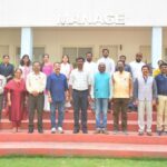


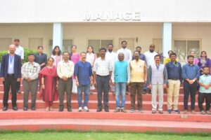
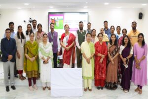
In this meeting note, Ruchi and Tara reflect on their participation in the DST-sponsored two-week training program, “Application of Geoinformatics for Women Scientists,” organized by the Indian Institute of Forest Management (IIFM), Bhopal, from November 18th-29th, 2024.
CONTEXT
IIFM, as a leading forestry research institution, recognizes the integral role of geoinformatics, including Geographic Information Systems (GIS) and remote sensing, particularly in areas like forest fire management, hydrology, and climate data analysis. IIFM has been proactive in adapting to the current geoinformatics landscape, including restructuring postgraduate courses and fostering capacity development initiatives through institutional alliances.
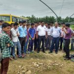
This DST-sponsored training program was designed to cultivate new competencies, career opportunities, and research priorities within the forestry, agriculture, and allied sectors. The program was held from November 18th-29th, 2024, and offered hands-on training in tools like Google Earth Engine and QGIS, familiarizing participants with the fundamentals of geoinformatics applications in emerging areas. Twelve participants from six states, representing diverse backgrounds including forestry, agriculture, veterinary science, and pollution control boards, were selected for the 12-day program.
The program was designed and executed under Dr. Jigyasa Bisaria, Chairperson of the Centre of Geoinformatics for Forestry, Climate Change, and Livelihood Support. The program’s broad focus encompassed the following themes:

TRAINING HIGHLIGHTS
Theme 1: Foundational Geoinformatics and Research Reorientation
Focus: Introduction to geoinformatics, encompassing remote sensing, GIS, GPS, and spatial data infrastructures. Emphasis on shifting research paradigms from traditional methods to innovative approaches like LiDAR and sensor-based technologies.
Key Learnings: Understanding fundamental geoinformatics terminology (geodesy, gravimetry, LiDAR, remote sensing types, sensors). Recognizing the need for capacity development and skill enhancement in line with modern agricultural and environmental challenges. Adopting innovative research methodologies for landscape management, wildlife conservation, change detection, and biodiversity modeling.
Reflections: Experts Dr. Jigyasa Bisaria and Dr. K. Ramesh provided valuable insights into current research practices and inspired a forward-thinking approach in geoinformatics towards evidence-based research.
Theme 2: Spatial Data Infrastructure and Drone Technology
Focus: Exploring the role of spatial data infrastructure (SDI) in Madhya Pradesh for land management, urban planning, disaster management, environmental monitoring, and rural development. Understanding the applications of drone technology, particularly in forest fire assessment and biodiversity preservation.
Key Learnings: Utilizing geospatial analysis and monitoring systems for improved public governance. Integrating drone applications into traditional forest management practices for enhanced biodiversity and forest resilience. Understanding the specifics of the Drone Policy 2021.
Reflections: Experts Dr. Sandeep Goyal, Mr. R. Arun Kumar, and Dr. Jigyasa Bisaria highlighted the critical role of geospatial technology in infrastructure development and forest management using drones, transforming traditional methods by offering more accurate, efficient, data-driven research techniques.
Theme 3: Pollution Monitoring and Control
Focus: Applying geoinformatics in pollution monitoring and control across various environments. Integrating GIS, remote sensing, and spatial analysis to monitor, assess, and manage pollution.
Key Learnings: Using geoinformatics tools to track environmental changes, identify pollution sources, and evaluate the effectiveness of pollution control measures. Leveraging data-driven decisions for public health protection and sustainable development.
Reflections: Experts Dr. Saumya Singh and Dr. Jigyasa Bisaria provided insights into new research areas and the skills required for impact-driven research. Hands-on training on Sentinel 2 imagery analysis using GEE was particularly valuable in signature extension machine learning.
Theme 4: Spatiotemporal Analysis with Google Earth Engine (GEE)
Focus: Utilizing GEE for spatiotemporal analysis, examining how spatial and temporal patterns evolve and interact. Applying GEE and machine learning for forest monitoring, management, and land cover classification.
Key Learnings: Efficient and accurate forest monitoring through satellite imagery, machine learning, and cloud-based infrastructure. Hands-on experience with GEE for cloud and shadow removal, image combination, and land cover classification using algorithms like random forest and K-means clustering.
Reflections: Experts Mr. Amit Biswal and Dr. Jigyasa Bisaria emphasized the importance of spatiotemporal analysis in forest cover analysis and change detection using GEE and machine learning. This information can help inform policymakers and promote sustainable land use advisory through extension professionals.
Theme 5: Ecosystem and Species Diversity Assessment with Remote Sensing
Focus: Assessing ecosystem and species diversity using remote sensing technologies. Understanding the use of Landsat and Sentinel imagery for vegetation classification and biodiversity assessments.
Key Learnings: Characterizing biodiversity by mapping and monitoring habitats, species, and ecosystem health. Understanding the role of remote sensing in habitat classification, biodiversity hotspot identification, phenological change monitoring, and climate change impact assessment.
Reflections: Experts Dr. C. Patnaik and Dr. Jigyasa Bisaria provided valuable insights into remote sensing applications for biodiversity characterization, mapping, and monitoring, offering innovative solutions for knowledge dissemination in extension research.

Theme 6: LiDAR and 3D Point Cloud Analysis for Forest Biomass Assessment
Focus: Utilizing LiDAR technology and 3D point clouds for precise forest biomass estimation. Calculating vegetation indices like NDVI using remote sensing software.
Key Learnings: Understanding LiDAR principles and its application in creating 3D forest canopy models. Using 3D point cloud data for individual tree detection and crown delineation. Calculating NDVI and other vegetation indices for assessing vegetation health and biomass.
Reflections: Experts Dr. Rajsekhar Gopalakrishnan and Dr. Jigyasa Bisaria highlighted the potential of remote sensing for precise forest biomass assessment, ensuring that valuable data-based information can be disseminated by extension workers on biomass in concerned forests, helping them make informed decisions about harvesting, thinning, and replanting.
Theme 7: Geoinformatics Applications in Hydrology
Focus: Applying GIS and remote sensing in water resource management. Using remote sensing for water body monitoring, water quality assessment, and hydrological feature mapping. Utilizing GEE and machine learning for land cover and land use mapping.
Key Learnings: Efficient and accurate water resource management through geoinformatics applications. Advanced analysis of remote sensing data using GEE and machine learning techniques.
Reflections: Experts Dr. T. Thomas and Dr. Jigyasa Bisaria showcased the potential of these technologies in addressing water resource challenges. Hands-on training on GEE and machine learning further enhanced the understanding of their practical applications in extension research, which often deals with geographically dispersed communities and resources. GEE’s cloud-based platform allows researchers to process and analyze massive amounts of geospatial data.
Further, GIS enables the creation of maps and spatial models that can be used to visualize different scenarios and evaluate the potential impacts of various management options. This is crucial for land use planning, infrastructure development, and disaster management. For example, maps showing areas at high risk of forest fire can be used to prioritize fire prevention and suppression efforts. Similarly, information on soil properties and crop health can be used to tailor agricultural extension services to the specific needs of farmers.

SUMMARY
Geoinformatics provides a powerful set of tools and techniques that can significantly enhance extension research and decision-making in a variety of fields, including Precision Agriculture, Forest Fire Management, Water Resource Management, Climate Change Adaptation, and Biodiversity Conservation. By enabling efficient data collection and analysis, improving decision-making processes, facilitating communication, and supporting targeted interventions, geoinformatics plays a crucial role in addressing contemporary challenges related to natural resource management, agriculture, and environmental sustainability.
RELEVANCE AND APPLICABILITY OF THE TRAINING FOR EXTENSION RESEARCHERS AND FIELD WORKERS
The training program on ‘Application of Geoinformatics’ effectively bridges the gap between traditional research methods and cutting-edge geospatial technologies, allowing professionals to better address contemporary challenges in agriculture, natural resource management, and environmental conservation. The training content, particularly the focus on remote sensing, GIS, and the use of drones and LiDAR technology, offers extension professionals an efficient and cost-effective means to collect spatial data over large and often geographically dispersed areas. This is especially valuable for extension workers who need to monitor vast agricultural landscapes, forests, and water bodies. By employing satellite imagery, aerial photographs, and drone data, researchers can assess crop health, monitor biodiversity, and detect environmental changes in real-time. This ability to collect and process large datasets empowers extension workers to make more informed decisions. Extension professionals often work at the grassroots level, where the ability to communicate complex issues to diverse stakeholders is essential. The training on GIS mapping and visual data representations enhances the ability to convey environmental and agricultural concerns effectively to policymakers, local communities, and other stakeholders.
WHY EXTENSION PROFESSIONALS SHOULD LEARN GEOINFORMATICS
In today’s rapidly evolving environmental and agricultural landscape, extension professionals must adapt to new technologies to remain effective in their roles. Geoinformatics offers several key advantages for extension professionals. The automation of data collection and analysis through tools like GIS, GEE, and remote sensing leads to more precise, evidence-based decisions efficiently with less time. This efficiency allows extension professionals to allocate more time to outreach, communication, and implementation of solutions on the ground. By learning geoinformatics, extension workers are preparing themselves for the future of environmental management.

OUR IMPRESSION
Course Director Dr. Jigyasa Bisaria and her team offered a comprehensive and modern educational experience that integrated hospitality, practical instruction, up-to-date facilities, relevant course content, and novel topics. A welcoming environment from the IIFM faculty made participants feel comfortable and motivated to engage actively with the subject matter. The accessibility of up-to-date GIS software (like ArcGIS, QGIS, or remote sensing tools) encouraged participants to learn new skills.
SCOPE FOR IMPROVEMENT
The two-week training program, specifically for women scientists, with a perfect number of participants, opens up a new path for the diversified application of geoinformatics in agricultural, forestry, and allied sectors. However, a more tailored, practical learning experience would empower female scientists by focusing on their strengths, providing them with real-world applications, and helping them to develop into leaders in science.
 Ruchi Singh is an Assistant Professor in the Department of Veterinary and Animal Husbandry Extension Education at the College of Veterinary Science and Animal Husbandry, Nanaji Deshmukh Veterinary Science University, Jabalpur, Madhya Pradesh 482001. She can be contacted via email at drruchivet@gmail.com.
 Tara Kumari is a Scientist-B in the Silviculture and Forest Management Division at the ICFRE-Rain Forest Research Institute, Jorhat, Assam 785010. Her email addresses are tarak@icfre.org and tararishiforestry@gmail.com.
Add Comment